Ancoris hero background

More than just maps, Google Maps Platform

Use Google Maps APIs to include maps in your website and mobile apps easily and quickly
GC-specialization-Location_Based_Services-no_outline

How we can help

Ancoris was one of the first companies globally to achieve the Google Cloud Location-based Services specialisation. This award from Google Cloud recognises both the support we offer to our customers to supply the Maps Platform licences, and also the added value of our consultancy services, all with location as the main focus.

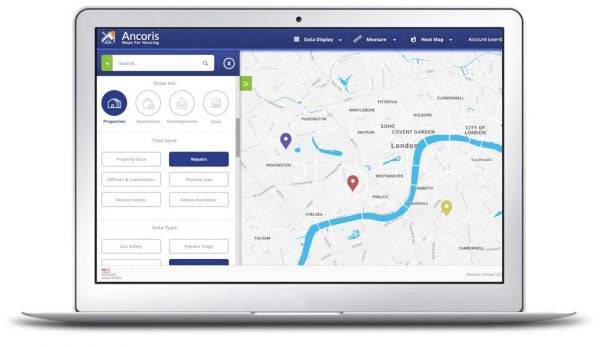
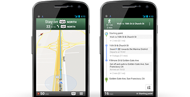
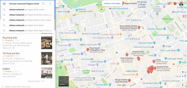
We work with organisations from across the world to develop, deploy and/or manage the use of the Google Maps Platform APIs within Web and mobile applications. We can help and advise you about your current service deployment, or develop the new application for you.

London by night
Visualising-data-600x347

Bring the power of maps to your applications

Google Maps Platform is made up of three core products—Maps, Routes and Places, to make it easier for you to find, explore and add new features to your apps and sites. Google Maps APIs are available for Android, iOS and web browsers, and as HTTP web services that let you pass information between systems.

What you need to know about the Google Maps Platform
5 ways Google Maps APIs help you do more with Google Maps
Google Maps Frequently Asked Questions


Maps

Engage your users with rich, accurate maps. Give them context with static or interactive maps embedded into your site or app. Create more engaging experiences with Street View and high resolution satellite imagery.

Customise the Google base map to suit your application. Visualise your own data, along with data from Google databases and third-party data, using heat maps, symbols and custom styles. That can include real-time asset tracking (vehicles, parcels or people) as well as insights into historical data such as insurance claims and property sales. 

Features included: Maps, Street View

Hands-holding-a-smartphone-600x400
MapsAPI-Feature-routing-1

Routes

Provide directions and accurate journey times as well as predict future travel times, based on live traffic data, with routes for driving, walking or cycling.

Create efficient routes to lower costs and improve customer experiences. You can add up to 23 waypoints to create optimised routes for mobile workers. The mileage calculator functionality will also help to decrease inaccurate mileage claims.

Improve workforce management, even during rush hour. Choose faster routes or reallocate deliveries to workers based on real-time traffic conditions. Use predictive traffic models to keep your workers out of slowdowns and avoid late deliveries.

Features included: Directions, Distance Matrix, Roads


Places

Places includes Google's 150m+ points of interest (POIs) globally and allows your users to obtain local information that is relevant to their search. Local information is key to obtaining the highest conversion rate and conversely the lowest bounce rate, which would see users leave your service to find more localised information, probably visiting Google Maps!

Help your users discover the world around them. with information to plan trips or select restaurants or choose a hotel. With Places, you can provide users data on names, addresses, ratings, reviews, contact information, and atmosphere of the locations they are researching, including ‘busier’ times which is key to today's social distancing requirements. .

Provide better services with precise location intelligence, avoiding missed deliveries or appointments, by making it easier for users to enter their correct invoicing and shipping details by automatically suggesting addresses as they type.

Features included: Place Details, Current Place, Find Place, Geocoding, Geolocation, Time Zone, Local Context

Places on Google Map in London

Looking to take your business to the next level with the Google Maps Platform?

The Google Maps APIs can be utilised in many different ways. We can help ensure you are using the right ones at the right times, only making billable calls when needed.

Most of the APIs come with ‘Advanced’ versions of them which are generally unlocked at the point of initial use. We can help assess whether these are the right ones for you and advise optimisation steps, eg the masking of unrequired API calls, to control costs whilst ensuring a strong Customer Experience remains.

Our specialists will assist you to:

Select the right APIs and services

We will review your business use case and estimate your usage levels. If you don’t have in house development skills, we can develop bespoke mobile or web applications for your business, or simply access to the correct licensing and invoicing.

Evaluate Google Maps pricing

We will also check if high-volume discounts could apply. Those rates, only available through a partner like Ancoris, are lower than the rates quoted online and are based on the level of usage of your services.

Provide Customer Success Services

We will provide phone support in the initial deployment and ongoing maintenance of your Google Maps implementation to keep it optimised and healthy.

Request a free consultation with Ancoris

What are you trying to solve?
We apply our expertise to help you overcome your toughest obstacles.

Latest Insights

Google Cloud Next '23: the Maps perspective

12th September 2023 / 8 min read

Google I/O 2023: The Maps updates

17th May 2023 / 6 min read

Geolocation, geolocation, geolocation: a Google Maps boost for retail

4th April 2023 / 5 min read

Free resources

Please download any of our resources to help with your research and project specifications